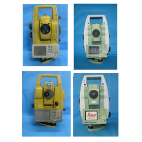
We have compiled a list of manufacturers, distributors, product information, reference prices, and rankings for Surveying Equipment.
ipros is IPROS GMS IPROS One of the largest technical database sites in Japan that collects information on.

Surveying Equipment Product List and Ranking from 9 Manufacturers, Suppliers and Companies | IPROS GMS

Last Updated: Aggregation Period:Jul 08, 2026~Aug 04, 2026
This ranking is based on the number of page views on our site.

Surveying Equipment Manufacturer, Suppliers and Company Rankings

Last Updated: Aggregation Period:Jul 08, 2026~Aug 04, 2026
This ranking is based on the number of page views on our site.

  1. ソニック Tokyo//Industrial Electrical Equipment
  2. カナデビア 機械事業本部 電子制御ビジネスユニット Osaka//Industrial Machinery
  3. アペオ技研 Aichi//others
  4. 4 null/null
  5. 5 北斗測量調査 本社 Niigata//Service Industry

Surveying Equipment Product ranking

Last Updated: Aggregation Period:Jul 08, 2026~Aug 04, 2026
This ranking is based on the number of page views on our site.

  1. Water Level Measurement Device "LGSM-2.V2" ソニック
  2. NetSurv RE カナデビア 機械事業本部 電子制御ビジネスユニット
  3. Multi-GNSS Surveying アペオ技研
  4. 4 [Free] Rental Comprehensive Catalog Vol.39 Excerpt Edition Renewal!
  5. 4 [Use Case] Acquisition of Detailed Topographic Data Using UAV Green Laser Surveying 北斗測量調査 本社

Surveying Equipment Product List

1~14 item / All 14 items

Displayed results

NetSurv RE

Maintaining the highly praised operability, now available on Android smartphones! Usable on tablet devices as well!

This product has been discontinued, and we are offering the successor model, NetSurv Re-α. It is approximately 50% smaller in volume compared to our NetSurv G6! Standard features include GPS, GLONASS, and QZSS reception capabilities! Certified as a Class 1 GNSS surveying instrument by the Geospatial Information Authority of Japan.

Added to bookmarks

Bookmarks list

Bookmark has been removed

Bookmarks list

You can't add any more bookmarks

By registering as a member, you can increase the number of bookmarks you can save and organize them with labels.

Free membership registration

Leica BLK3D Premium Editon

The Leica BLK3D is a portable photogrammetry tool. Measurements can also be taken on the display.

The basic functions of the BLK3D are four + with optional features for wide and effective use!! ■ Reality Capture: Take photos and tap any two points on the screen to measure distance. - Captured image and measurement results https://www.movecorp.co.jp/products/leica/blk3d_reality.html ■ Laser: Measurement with laser distance meter function allows for area calculation and horizontal distance measurement. ■ New Project: Create a project folder with any name to manage images, drawings, etc. ■ Organizer: Export selected data, move, rename, tag, and delete. * This product can be utilized more broadly by purchasing additional licenses. For details, please visit our website (related link).

  • Color camera
  • Surveying Equipment

Added to bookmarks

Bookmarks list

Bookmark has been removed

Bookmarks list

You can't add any more bookmarks

By registering as a member, you can increase the number of bookmarks you can save and organize them with labels.

Free membership registration

Measuring instrument GPS and total station integrated type

Integrated Total Station Smart Station GNSS (GPS/GLONASS)

The world's first total station fully integrated with GPS, realizing a surveying method that anticipates the future!

  • Other measurement, recording and measuring instruments
  • Surveying Equipment

Added to bookmarks

Bookmarks list

Bookmark has been removed

Bookmarks list

You can't add any more bookmarks

By registering as a member, you can increase the number of bookmarks you can save and organize them with labels.

Free membership registration

[Example] River Surveying and Plane Surveying

Effective for significant time savings! Introducing examples utilizing network-based RTK.

Kyushu Central Surveying Co., Ltd. introduces a case study utilizing network-based RTK in "river surveying and leveling (reference points)." The company previously tracked the position of boats using a total station. However, by employing "network-based RTK surveying," they installed distance markers and conducted depth surveys using RTK measurements with the mobile station loaded on the boat, significantly improving work efficiency and accuracy. Additionally, since the boat is equipped with a depth sounder, coordinates and depth results are recorded in real-time, allowing for the creation of highly accurate contour and depth maps. 【Benefits and Effects】 ■ Improvement in work efficiency and accuracy ■ Usable in other surveying tasks ■ Effective for significant time savings *For more details, please refer to the PDF document or feel free to contact us.

  • Other network tools
  • Other measurement, recording and measuring instruments
  • Surveying Equipment

Added to bookmarks

Bookmarks list

Bookmark has been removed

Bookmarks list

You can't add any more bookmarks

By registering as a member, you can increase the number of bookmarks you can save and organize them with labels.

Free membership registration

Water Level Measurement Device "LGSM-2.V2"

For underwater structure leveling and underwater topography survey work! High-precision and stable measurements are possible.

The "LGSM-2.V2" is a high-precision level gauge used for underwater leveling surveys of underwater structures, underwater topography, and other underwater construction works in ports, coastal areas, lakes, and rivers. The leveling method is a simple approach that applies the principle of communicating vessels, allowing for high precision and stable measurement values. Compared to general staff measurement methods, it reduces the labor of the operator and the surveying time (by 1/2 to 1/4), and due to underwater work by divers, there are fewer constraints from weather conditions, making project management easier. 【Features】 ■ The measurement principle applies the same principle of communicating vessels as "water leveling," enabling high-precision and stable measurements. ■ Compared to general staff measurement methods, it reduces the labor of the operator and the surveying time (by 1/2 to 1/4). ■ Due to underwater work by divers, there are fewer constraints from weather conditions, making project management easier. ■ The measurement range is within a 50m radius centered on the reference point, with a height difference range of +5 to -15m. ■ The accuracy is ±2m within ±2cm, and other ranges can be measured within ±1%. *For more details, please download the PDF or feel free to contact us.

  • Other measurement, recording and measuring instruments
  • Surveying Equipment

Added to bookmarks

Bookmarks list

Bookmark has been removed

Bookmarks list

You can't add any more bookmarks

By registering as a member, you can increase the number of bookmarks you can save and organize them with labels.

Free membership registration

Leica BLK3D < with two effective perpetual licenses >

This product is the Leica BLK3D, a portable photogrammetry tool with two effective perpetual licenses!!

The basic functions of the BLK3D are four + optional features for wide and effective use!! ■ Reality Capture: Take photos and tap on any two points on the screen to measure distance. - Captured image and measurement results https://www.movecorp.co.jp/products/leica/blk3d_reality.html ■ Laser: Measure using the laser distance meter function, allowing for area calculations and horizontal distance measurements. ■ New Project: Create a project folder with any name to manage images, drawings, etc. collectively. ■ Organizer: Export selected data, move, rename, tag, and delete. * This product can be utilized more broadly by purchasing additional licenses. For details, please visit our website (related link).

  • Color camera
  • Surveying Equipment

Added to bookmarks

Bookmarks list

Bookmark has been removed

Bookmarks list

You can't add any more bookmarks

By registering as a member, you can increase the number of bookmarks you can save and organize them with labels.

Free membership registration

Multi-GNSS Surveying

Supports various measurement tasks! Network-based GNSS and wide-area high-precision GNSS measurements.

At Apeo Giken, we use GNSS surveying equipment to establish and inspect reference points that serve as the basis for map creation and various surveys. From public works to construction surveys, we provide a series of quality assurance tailored to the conditions of the work and the required objectives and accuracy, from actual measurements to precise observation planning and results adjustment. By adding a network system that utilizes communication and electronic reference points, we enable accurate three-dimensional positioning to be measured anytime and anywhere. We accommodate various measurement tasks according to needs, from network-based "immediate coordinates and elevation on-site" to static observations pursuing millimeter-order positional and elevation accuracy. 【Features】 ■ If there are no known points nearby, calculations can be made from electronic reference points. ■ Leveling surveys using GNSS are also authorized. ■ For surveys conducted by government agencies, we support everything from public survey applications to result verification. For more details, please refer to our catalog or feel free to contact us.

  • Contract measurement
  • Surveying Equipment

Added to bookmarks

Bookmarks list

Bookmark has been removed

Bookmarks list

You can't add any more bookmarks

By registering as a member, you can increase the number of bookmarks you can save and organize them with labels.

Free membership registration

[Case] Establishment of reference points due to the digitization of road ledgers.

Utilization of network-type RTK in the establishment of reference points due to the digitization of road ledgers!

We would like to introduce a case study utilizing network-type RTK in the "Establishment of Reference Points Accompanying the Digitalization of Road Ledger" by Ariake Surveying Development Co., Ltd. 【Work Details】 ■ Established 70 new points over a total length of 80 km * Network-type RTK involves observations of more than 10 epochs (single point observation method) 【Benefits and Effects】 ■ The conventional ground method using total stations took 30 person-days (3 people × 10 days), whereas in this case, it was completed in 3 person-days (1 person × 3 days). ■ Significant cost reduction was achieved by reducing both working time and manpower. * For more details, please refer to the PDF document or feel free to contact us.

  • Other network tools
  • Other measurement, recording and measuring instruments
  • Surveying Equipment

Added to bookmarks

Bookmarks list

Bookmark has been removed

Bookmarks list

You can't add any more bookmarks

By registering as a member, you can increase the number of bookmarks you can save and organize them with labels.

Free membership registration

[Use Case] Acquisition of Detailed Topographic Data Using UAV Green Laser Surveying

Introduction of a case study utilizing an offshore breakwater mound where healthiness has been confirmed without significant dispersion.

We would like to introduce a case study on the utilization of detailed topographic data acquisition through UAV green laser surveying that we have handled. The introduction of green laser technology has made it possible to continuously measure three-dimensional point clouds from the air to underwater. By mounting it on a UAV and measuring from a low altitude, we can obtain data with a high point density that allows us to understand the shape of individual wave-dissipating blocks. In confirming river erosion conditions, we can visually grasp the relationship between structures and erosion conditions by acquiring detailed point cloud data of both structures and topography without distinguishing between air and underwater. [Case Overview] ■ Use Case 1: Confirmation of river erosion conditions ■ Use Case 2: Investigation of offshore mound *For more details, please refer to the PDF document or feel free to contact us.

  • Other measurement, recording and measuring instruments
  • Surveying Equipment

Added to bookmarks

Bookmarks list

Bookmark has been removed

Bookmarks list

You can't add any more bookmarks

By registering as a member, you can increase the number of bookmarks you can save and organize them with labels.

Free membership registration

【クラウド型現地管理DXツール導入事例】株式会社サニックス 様

ソーラーパネル設置と点検を安全・正確・迅速に!働き方改革を推進!

株式会社サニックス様にクラウド型現地管理DXツールの『くみき』を 導入した事例をご紹介します。 同社は、ドローン測量ツールは初期から導入をしていましたが、 海外製のため、サポート対応や撮影などの扱いに課題を感じていました。 当製品を導入することによって効率的に精度の高い点検をすることが できるようになりました。また、作業時間も減り、働き方改革の推進にも 一役買っています。 【課題】 ■海外製のため、サポート対応や撮影などの扱いに悩んでいた ■一人ひとりの仕事の量と質を落とすことなく業務時間を短縮すること ※詳しくはPDF資料をご覧いただくか、お気軽にお問い合わせ下さい。

  • Other measurement, recording and measuring instruments
  • Analytical Equipment and Devices
  • Image analysis software
  • Surveying Equipment

Added to bookmarks

Bookmarks list

Bookmark has been removed

Bookmarks list

You can't add any more bookmarks

By registering as a member, you can increase the number of bookmarks you can save and organize them with labels.

Free membership registration

Now's not the time to ask! 'How to Use Surveying Equipment Correctly - Rental Edition'

Do you know how to use the correct measuring instruments? We will introduce our surveying equipment rental while explaining questions such as which surveying instrument is best for this site!

As a professional in surveying who has responded to the needs of many customers, we are offering a free booklet titled "How to Use Surveying Equipment Correctly - Rental Edition," which provides detailed explanations about the types of surveying equipment and important points to consider when using them. "What will you lend me?" "Will you teach me how to use it?" "Isn't it going to break since it's used repeatedly?" We address these questions in a Q&A format. Our company also provides support for rental items. Please feel free to contact us. [Contents] ■ What will you lend me? ■ Will you teach me how to use it? ■ Isn't it going to break since it's used repeatedly? *For more details, please refer to the PDF document or feel free to contact us.

  • Other contract services
  • Rental/lease
  • Other services
  • Surveying Equipment

Added to bookmarks

Bookmarks list

Bookmark has been removed

Bookmarks list

You can't add any more bookmarks

By registering as a member, you can increase the number of bookmarks you can save and organize them with labels.

Free membership registration